Singapore Reaches the Physical Limits of Surface Drainage
A thirty percent capacity boost along Bukit Timah Road demonstrates why dense Asian metropolises must push stormwater infrastructure underground.
SINGAPORE
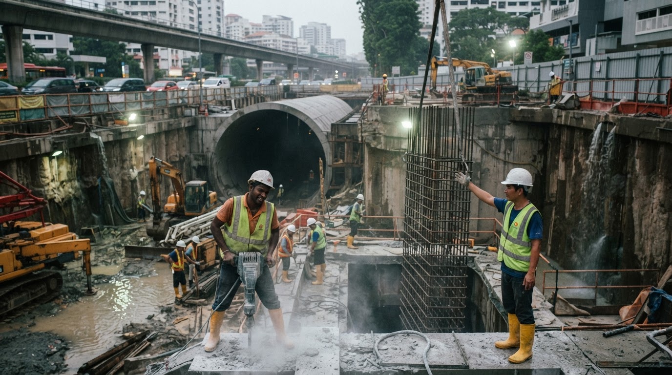
The completion of civil engineering works along the Upper Bukit Timah Canal in Oct 2026 delivered 30 percent more capacity to one of Singapore's most vulnerable drainage corridors. Stretching along Bukit Timah Road near Rifle Range Road and Jalan Kampong Chantek toward King Albert Park MRT, the project concluded seven years of drainage adjustments designed to absorb heavy tropical precipitation. Behind the municipal announcement lies an unmistakable physical threshold. Surface drainage improvements across prime urban corridors are reaching their geometric ceiling, compelling water authorities to rethink how dense Asian cities manage climate vulnerabilities.
Disruptions spanning seven years since 2019 illustrate why linear surface expansions carry steep economic frictions. Contractors widening the open canal had to navigate dense transport infrastructure, preserving vehicular flow along Bukit Timah Road while coordinating adjacent corridor works. Every additional meter of canal expansion encroached on tightly constrained roadway boundaries. While the finished channel delivers needed hydraulic relief, stretching construction across seven years underscores how difficult open-trench engineering has become within built-up urban corridors.
The Cost of Surface Constraints
Public investment in drainage is driven by the severe economic disruptions caused by flash flooding across high-density real estate and transit arteries. Transport nodes such as King Albert Park MRT cannot experience frequent inundations without stalling commercial activity and degrading local property access. Protecting road stability along Bukit Timah Road justifies capital commitments, where drainage project programs can command USD 60000000 in public resources. Commercial property owners and commuters secure immediate reliability from the upgraded channel, but the physical space required to execute linear widenings has essentially expired.
Squeezing additional capacity from open channels generates diminishing returns once roadway margins and commercial frontages leave no room to excavate.
Civil planners can no longer treat surface widening as a repeatable solution along established alignments. Expanding an existing drainage canal necessitates occupying surface land, forcing compromises between vehicular lanes, pedestrian footpaths, and urban utilities. The recent upgrade succeeded in providing 30 percent more capacity, yet attempting a similar widening along the exact same corridor in the future would require prohibitive land acquisitions. Surface engineering has solved the immediate drainage deficit, but it cannot scale to meet worsening storm intensities without tearing apart adjacent roadways.
Moving Capital Underground
Confronting these physical boundaries, national water agency PUB is shifting its planning attention toward the broader Bukit Timah catchment. The agency confirmed it will study longer-term flood mitigation measures for the wider Bukit Timah catchment, including underground detention structures to temporarily store excess stormwater. Subterranean retention transfers the civil footprint hundreds of meters beneath the surface, decoupling stormwater containment from congested street-level parcels.
Subsurface engineering introduces formidable trade-offs that municipal balance sheets must navigate. Excavating massive underground detention tanks beneath active urban zones demands advanced tunneling machinery, complex utility diversions, and elevated capital outlays compared to standard concrete ditches. Unlike gravity-driven surface canals, subterranean facilities frequently require mechanical pumping systems to empty stored water once downpours subside, adding permanent operational expenditures. Municipal planners must decide whether absorbing these operational costs is preferable to the recurring losses of inundated commercial corridors.
Singapore has extracted the maximum viable volume from the Upper Bukit Timah Canal, demonstrating the physical boundaries confronting dense Asian financial hubs. Protecting prime districts against intensifying rainfall will increasingly require burying retention infrastructure beneath urban transit networks. The long-term safety of these vital economic corridors now depends on whether public finances can absorb the escalating costs of moving water management entirely underground.
Sources
Newsletter
Pacific Daily
A curated briefing from Thailand, Asia-Pacific and the world.