Alluvial Roadbed Engineering Collides with Amazon Basin Hydrology
Surface access corridors built for Canadian-backed potash extraction disrupt the shallow water tables sustaining riverine settlements
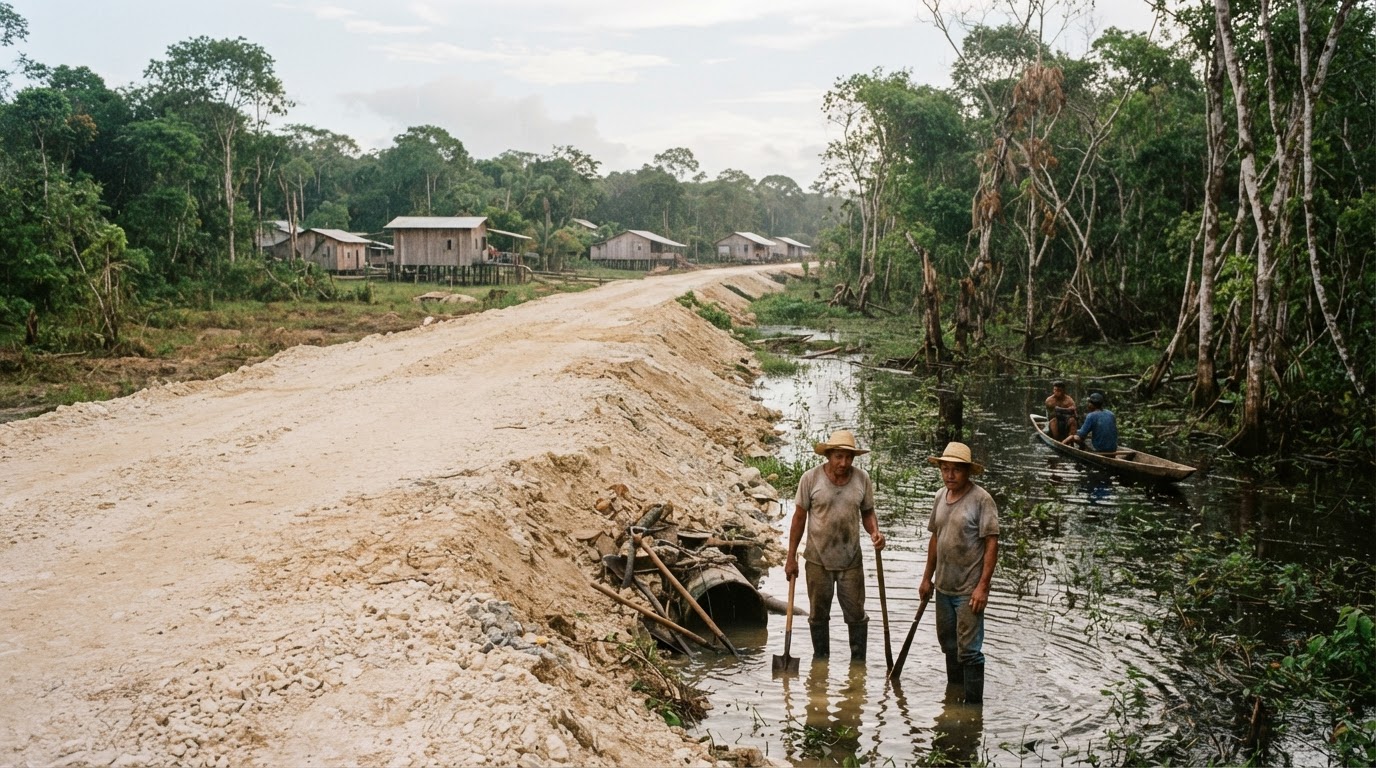
Heavy civil engineering in alluvial basins presumes that surface runoff can be safely diverted through ditching. That calculation failed in Autazes, in Brazil’s Amazonas state, where physical preparation for mineral extraction severed subsurface pathways feeding local water networks. Road crews cutting an access route for the Canadian-backed Potássio Autazes project altered ground permeability enough to cause at least two sacred springs to dry up, according to the Indigenous Mura people.
Transport corridors designed for heavy equipment treat floodplains as inert ground. Aggregate compaction and perimeter ditching are executed to support haulage loads, yet those interventions block the shallow aquifers feeding low-gradient catchments. When an access track cuts across alluvial terrain, the disruption is immediate. Soil consolidation acts like a buried subsurface dike, shifting hydrostatic pressure away from adjacent creeks and drinking basins.
Waterway Continuity Versus Overland Haulage
Controversies spanning a decade have tracked the Autazes venture, reflecting the friction between overland extraction logistics and existing water transport. For riverside settlements, channels provide the functional equivalent of paved roads. Inland drilling access built across wetlands compromises the shallow hydrology that allows river craft to navigate between settlements.
Filipe Mura, chief of the affected Lago do Soares village, detailed the downstream impact of the earthworks via WhatsApp:
There is a profound sense of loss. We realize we may be losing what belongs to us — our territory, our culture, and, above all, the very life that exists in this place.
Project developers regularly present haul roads as self-contained civil works requiring standard culverts. Their economic models assume that standard roadside grading leaves surrounding drainage intact. In corporate filings, terrestrial access is treated as secondary support infrastructure rather than an active barrier across an unmapped hydrological table.
Alluvial reality breaks that assumption. Earthen causeways disrupt the horizontal percolation that keeps natural spring heads charged during dry intervals. Starving those vents removes the baseline flow required to sustain daily settlements across Careiro and Urucurituba. The Organization of Mura Indigenous Leaders, alongside community representatives including Willian Rodrigues Filgueira, faces a landscape where terrestrial engineering steadily reduces riparian utility.
The Unresolved Engineering Constraint
Mining finance relies on accelerated road construction to prove asset viability before commercial processing begins. Foreign capital backing Potássio Autazes targets long-term fertilizer output, yet executing earthworks without mapping subsurface hydrogeology creates severe community resistance. Diverting water to stabilize haul tracks trades regional water security for short-term logistical convenience.
Cross-border capital cannot isolate commercial logistics from basic drainage mechanics. While Canadian public financing directs capital into regional hubs elsewhere—such as committing $2 million to an economic hub backed by the Philippines, the United States, and Japan—overland resource schemes in South America face unyielding local physics. Road networks fail when their sub-base design breaks the natural hydrology of the communities they traverse.
Whether this corridor proceeds now depends on engineering regulators forcing developers to demonstrate subsurface hydrological continuity before another kilometer of road is cleared.
Sources
Newsletter
Pacific Daily
A curated briefing from Thailand, Asia-Pacific and the world.