The Fragile Horizon of Singapore's Clean Air Geography
Hourly improvements across northern and eastern corridors mask the persistent atmospheric pressures shaping regional mobility.
SINGAPORE
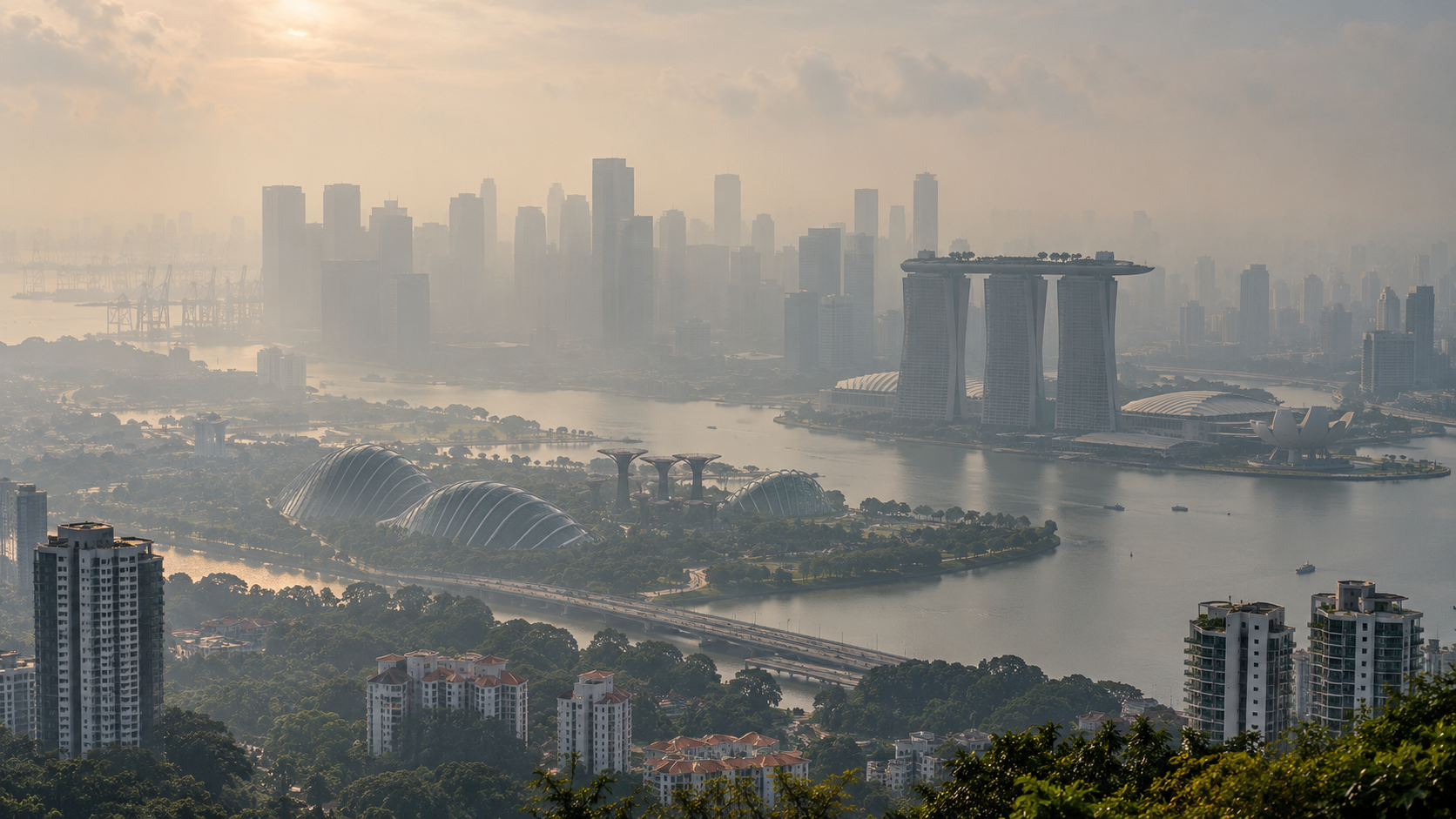
Across central Bishan, the midday light flattens against a muted horizon. Towers that usually mark the skyline blur into a pale wash, obscured by fine particulate matter drifting across maritime boundaries. Urban movement continues along ground-level corridors, yet the visual clarity that typically defines the island has dissolved. This recurrent autumnal atmospheric shift strips away the polished veneer of municipal control, returning public life to the rhythm of regional winds.
On Wednesday, air quality showed brief respite as one-hour PM2.5 readings dropped into the normal band across northern sectors alongside southern and eastern districts. Yet baseline exposure told a starker story. At 3pm, the 24-hour Pollutant Standards Index remained in the unhealthy range across the western and central districts. By 7pm, hourly PM2.5 levels were elevated again in those same central and western corridors.
The divergence illustrates how swiftly atmospheric conditions fracture across a compact island.
Shifting Currents and Fragmented Skies
The National Environment Agency issued forecasts projecting unhealthy conditions for Thursday, noting that smoke haze from Kalimantan could drift directly toward Singapore before wind shifts bring further plumes from Sumatra into the weekend. Outdoor routines depend entirely on unseen maritime air masses.
The temporary reprieve of a single afternoon reading does not alter the broader airborne trajectory.
Destination planners frequently treat clean air as an ambient background amenity, permanent and guaranteed by municipal design. When transboundary haze arrives, that assumption collapses. Visitors encounter an environment where movement must adjust to regional atmospheric chemistry rather than transit schedules. Technocratic responses attempt to smooth over these disruptions through fine-grained monitoring. By dividing territory into distinct monitoring sectors, authorities provide a sense of administrative order over ambient skies. A runner in the east might see normal readings and proceed outside, while residents in the west face elevated particulate exposure under the same sun. Such micro-geographies encourage a false confidence, treating wind-borne particles as though they halted at administrative boundary lines.
Air currents ignore municipal perimeters.
The Regional Reality Behind the Window
Smoke originating from agricultural clearing and peat fires in Kalimantan and Sumatra remains tied directly to land-use economies across Southeast Asia. Singapore captures the financial dividends of regional commodity markets while absorbing the physical emissions of that very trade. The resulting haze settles over commercial avenues and public housing blocks without distinction.
Tourism marketing rarely acknowledges this seasonal vulnerability. Destination narratives present the city as an indoor sanctuary sheltered from tropical instability, relying on climate-controlled transit links and enclosed walkways to offer short-term isolation. Yet the outdoors inevitably reasserts itself at every street crossing. Relying on indoor buffers simply concentrates activity inside air-filtered enclosures, creating a divided urban experience where clean air functions as an interior convenience rather than a universal common.
By Thursday and into the weekend, as winds turn from Kalimantan toward Sumatra, public attention will remain tethered to shifting dials. The cadence of daily life will track the dispersion of smoke across the strait. This seasonal haze exposes a stubborn reality for island hubs: no degree of local infrastructural refinement can insulate a city from the environmental currents of its geographic basin.
Sources
Newsletter
Pacific Daily
A curated briefing from Thailand, Asia-Pacific and the world.