The Erasure of Kila and the Limits of Earthmoving Enforcement
Backfilling artisanal mine shafts in Gashaka-Gumti substitutes heavy machinery for enduring territorial governance
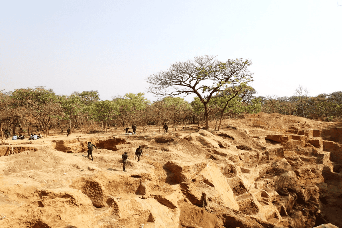
Earthworks reveal political priorities with peculiar clarity. When heavy machinery moves into a national park to backfill shafts and pits, the intervention asserts physical authority across contested terrain. At the Kila mining area within Gashaka-Gumti National Park, the state chose mechanical remediation over permanent administrative presence. Bulldozers flattened the workings of more than 4,000 miners who vacated the perimeter before soldiers arrived in July.
The operation treats complex land occupation as a drawing that can be scraped flat. Tunde Morakinyo, executive director of the Africa Nature Investors Foundation, confirmed that no shots were fired during the military-backed action, presenting the clearance of Nigeria’s largest national park as an orderly reclamation. Bulldozers were brought in to eliminate the mining pits and shafts. The partnership managing Gashaka-Gumti opted for immediate spatial erasure. Spoil heaps were pushed back into hollows, smoothing the forest floor into a clean surface.
Yet landscape modifications cannot dismantle the geographic incentives that produced them. A gold mining camp is an informal spatial network shaped by deposit veins, footpaths, and supply chains rather than formal property lines. When four thousand workers withdraw without armed confrontation, their departure functions as dispersal rather than collapse. Gold deposits remain beneath the surface. The state, meanwhile, maintains only an intermittent patrol footprint across a sprawling perimeter.
The Architecture of Evacuation
Territorial stewardship cannot rely on earthmoving machinery. An excavation filled with uncompacted soil is merely an altered contour, not an established frontier. The military secures an empty clearing, but a dense conservation zone refuses to function as an impermeable barrier. In the absence of sustained settlement, defensive checkpoints, or economic integration, the line separating ecological sanctuary from artisanal extraction remains completely porous.
International conservation strategy routinely embraces this form of sudden displacement. As officials gather in Armenia for the U.N. biodiversity summit in October, institutional debates center on formal preservation quotas for 2030, including protected land targets of 30 percent. Yet global targets frequently disregard the architectural realities of enforcement on remote frontiers. Drawing administrative boundaries across maps does not build local compliance. Collapsing pits creates a temporary physical void, leaving the underlying resource draw unaltered.
Unresolved Terrain
The spatial dilemma across Gashaka-Gumti is structural. Park managers from the Africa Nature Investors Foundation approach governance through professionalized conservation, seeking to establish stable ecological buffers. Even so, remote topography resists remote control. Miners entered Kila because deposits were accessible, trails were established, and official oversight was distant. Countering those factors requires civic infrastructure, durable institutional presence, and monitored boundaries rather than periodic mechanical clearance.
Mechanical erasures produce an illusion of control. The ground appears level, but the socio-spatial geography remains intact. When authorities treat the filling of pits as definitive enforcement, they invite gradual return. Soldiers can deploy machinery in July, but the unmonitored forest retains its paths.
Sources
Newsletter
Pacific Daily
A curated briefing from Thailand, Asia-Pacific and the world.