Waterway Enclosure Alters Artisanal Access on the Vaza-Barris River
Physical demarcation along Sergipe riverbanks illustrates how municipal expansion conflicts with intertidal resource gathering.
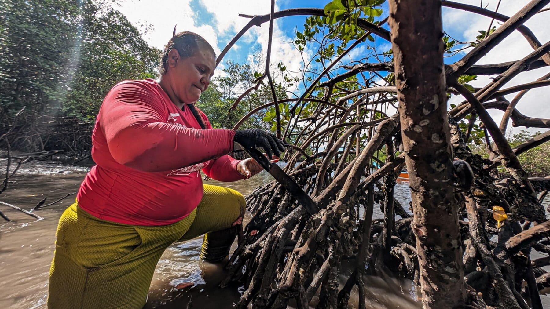
Shoreline harvesting along the Vaza-Barris river depends on an operational reality that formal maritime zoning rarely accommodates. Across the water from Aracaju, the state capital of Sergipe, traditional oyster gathering operates strictly within tidal windows rather than surveyed property lines. Gatherer Adriana Hora dos Santos enters the intertidal zone waist-deep in water, working through mud that reaches her thighs. Her equipment is minimal: a pink Lycra shirt for skin cover and a machete measuring just over 40-centimeters, or 16-inches, long to pry oysters from submerged roots. The entire extraction sequence relies on unobstructed physical transit between the open river channel and the mangrove fringe.
Recent spatial demarcation along what harvesters describe as an enclosed river exposes the friction between expanding urban frontage and working riparian corridors. Urban structures in Aracaju present a modern perimeter, while the opposite mud banks function as active harvesting grounds. When waterfront property lines and physical barriers seal the riverbank, the direct landing routes connecting the current to the roots are cut off. Santos organizes her work through the Movement of Women Shellfish Gatherers, known as MMS, using collective routines to maintain physical access against encroachment.
"We are always in a flock,"
Santos notes regarding this operational arrangement. Group deployment serves as a practical counterweight where entry corridors are systematically squeezed.
Estuarine boundaries and regulatory disconnect
Maritime navigation rules typically evaluate waterways through navigational draft, channel clearance, and registered vessel traffic. Gathering by hand or from unpowered skiffs fits poorly into these formal metrics. Because artisanal harvesters work during specific tidal intervals on foot or right at the waterline, administrative regimes frequently treat estuarine banks as unoccupied land buffers rather than productive working space. When riverfront landholders extend fences and physical demarcations down toward the water, they effectively sever the pathways gatherers require to reach shellfish beds.
Riparian property owners and administrative authorities justify demarcation through private property rights, asset security, and the need to curb unregulated shoreline activity. Their technical argument holds that clear physical boundaries establish public order, limit shoreline erosion from unmonitored foot traffic, and protect riparian assets against uncontrolled human intrusion. From an administrative viewpoint, fencing off waterfront margins represents an orderly application of property law.
Collective transit against physical displacement
That regulatory perspective misjudges the functional requirements of estuarine extraction. Closing the shoreline boundary does not stop resource gathering; instead, it forces gatherers to walk through hazardous deep mud over far longer distances or enter the river at dangerous current choke points. Forcing workers to wade further into tidal channels to circumvent private fences introduces direct operational risk, particularly when navigating shifting currents with a 16-inch blade in hand. Physical enclosure creates immediate safety hazards rather than environmental protection.
Coastal managers throughout the region face a comparable dilemma where estuarine perimeters meet urban real estate. When local planning schemes prioritize fixed waterfront developments over tidal harvesting routes, the cost of spatial exclusion falls entirely on manual harvesters. Physical demarcations convert an open estuarine edge into a fragmented barrier that obstructs traditional navigation and gathering alike.
The decisive operational constraint remains unresolved: coastal governance frameworks continue to define waterfront property down to the high-water line, leaving artisanal gatherers on the Vaza-Barris river without recognized transit corridors across rapidly enclosing shorelines.
Sources
Newsletter
Pacific Daily
A curated briefing from Thailand, Asia-Pacific and the world.